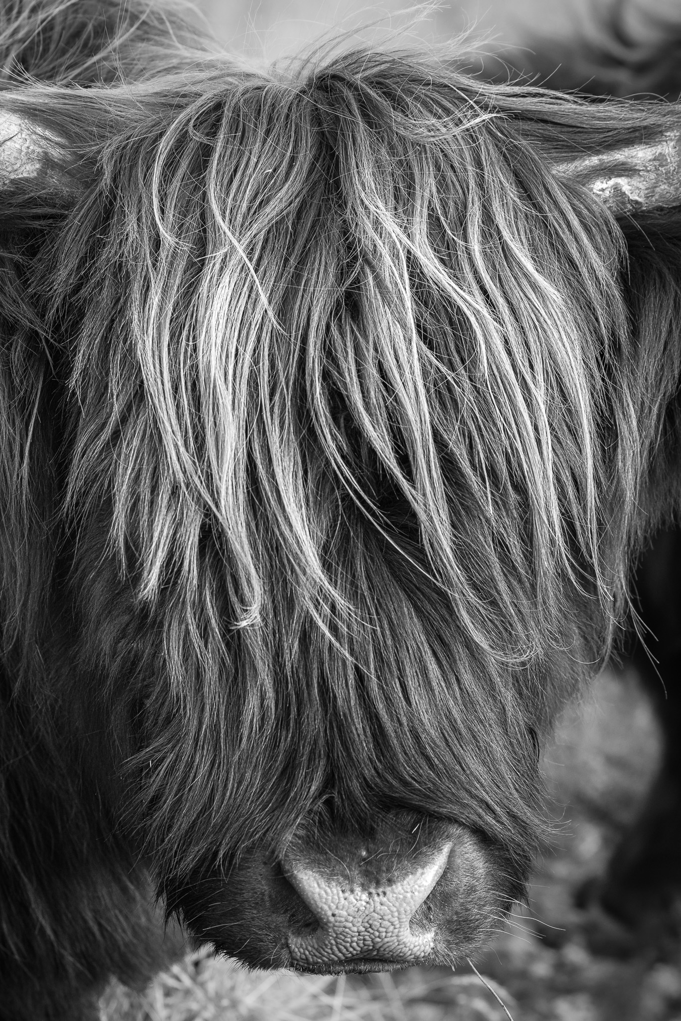
I went to New Zealand to photograph landscapes and came home with an indefensible number of photos of cows. I regret nothing.
Here is the situation. New Zealand has the best-dressed livestock on the planet, and I will not be taking questions. The highland cows alone are worth the airfare — enormous, unbothered, with the exact haircut of a rock guitarist who’s been through some things and come out serene. They look at you like they’ve read your emails and decided to forgive you.
The llamas are running a close second, mostly on attitude. And the sheep — well, there are a lot of sheep in New Zealand, so statistically some of them are going to be photogenic, and they are. I’d be lining up a wide landscape, some genuinely serious composition, and a sheep would wander into frame with better light on it than the mountain.
I don’t have a grand point here. Not every photograph has to be about the raw, untouched majesty of the end of the earth. Sometimes it’s about a cow with a fantastic fringe. The trip that produced the serious South Island guide also produced a small gallery of extremely dignified farm animals, and I think both are allowed to exist.
A few of these may end up as prints, because apparently I now make animal portraits. If a highland cow ends up on a postcard, you’ll know exactly why. Until then — see where I’ve been. It’s mostly mountains. It’s a little bit cows.
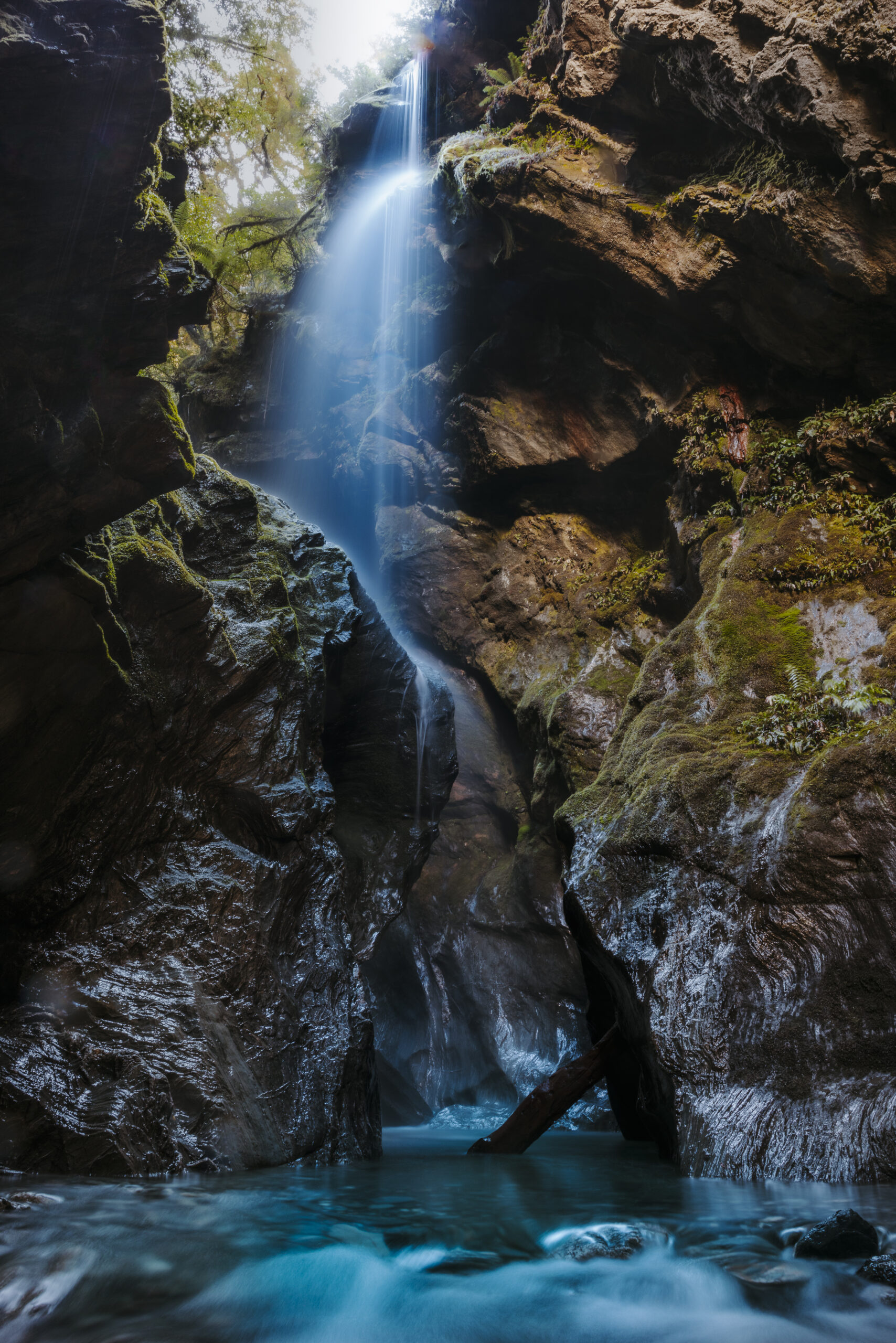
Everyone else had a plan for the day. Alex was golfing. Matt and Rachel were shopping. And I had a set of GPS coordinates I’d heard were worth the drive, with one small problem: I wasn’t entirely sure the place existed.
Not “existed” in a philosophical way. Existed in a “the internet said there was a cave and a waterfall back here, but the internet says a lot of things, and it’s probably flooded and definitely cold” way. So I rented a car and drove toward them anyway.
I stopped at the Blue Pools first, which are exactly as advertised — glacial water so clear it plays tricks on your sense of depth. Then I kept going, out toward Haast Pass, to the coordinates. The water was up. It was cold in the way that gets into your decision-making. But I came prepared — I always come prepared, because the entire premise of what I do is that I was standing in the actual place, and you can’t stand in the actual place from the warm car — and I got back into the cave, to the waterfall, and made the photographs I’d driven out there for.
Why this is the whole brand in one drive
I sell real photographs of real places. That line does a lot of quiet work. It means every image has a morning attached to it, a weather report, usually a mild bad decision. The Haast cave is the literal version: nobody handed me that frame. I drove to a coordinate I wasn’t sure was real, on my one free day, and got cold on purpose.
I’m not telling you this to sound rugged. I’m telling you because when you buy one of these — a postcard, a print, the eventual wall-sized edition — you’re buying the part where I actually went. That’s the difference between what I make and a stock library or an AI that has never once had wet socks. My feet were cold. That’s the product.
If you want to follow the same road
The Haast run is one leg of a much bigger South Island loop. I mapped the whole thing — Queenstown to Milford to Haast to the Wanaka Tree to Tekapo — in the South Island photographer’s guide, including where to point the camera and which stops are worth the detour. The cave photos are heading into the print store as I finish them. Until the wall-sized version exists, start small. It still counts.
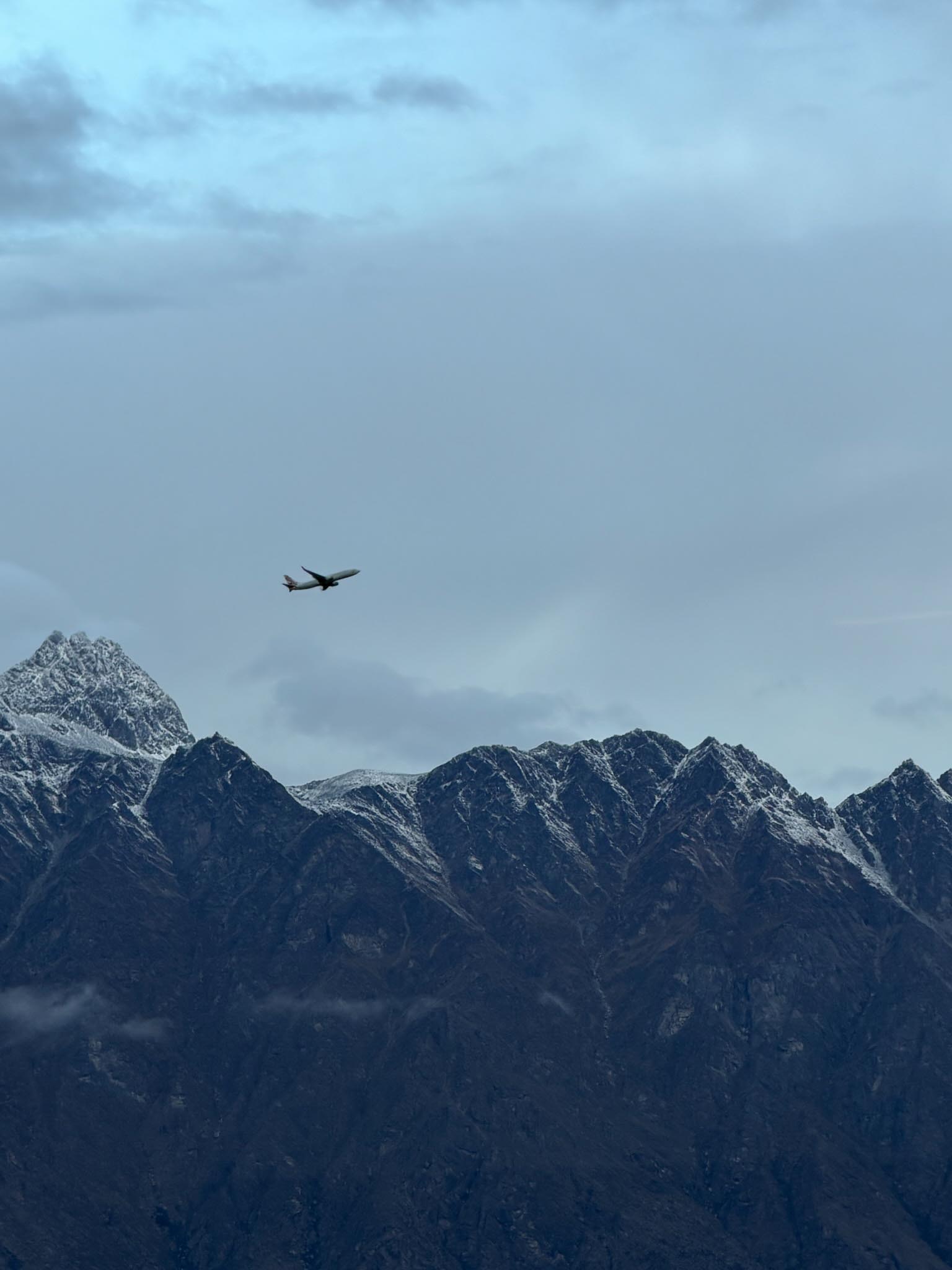
Queenstown’s airport is tucked between mountains, which is lovely in a photograph and slightly less lovely when you are trying to physically land an airplane in it.
We came in the first time and got close — close enough to see individual blades of grass, close enough that everyone had already done the quiet thing where you decide the flight went fine and you’re basically home. Then the engines spooled back up and we climbed. Wind. The pilot came around and tried again from the other runway direction, got down to what felt like fifty feet, and pulled up a second time. Two runs at the ground, two polite retreats, and then the announcement nobody wants on the leg they’ve been looking forward to for two years: we were diverting to Christchurch for the night.
Now, here’s the thing about traveling with Matt. Matt is a master planner. The kind of person who has a backup dinner reservation for a city he was not supposed to be in. We hadn’t been on the ground in Christchurch for an hour before he’d produced a plan: Kaiser Brew Garden, in the Riverside Market — a whole building of restaurants that used to be shipping-container eateries, now a proper food hall. We ate well, slept, and flew back the next morning, and this time the mountains let us in.
I want to be honest about why I’m telling you this instead of just showing you the pretty version. The pretty version is real too — Queenstown turned out to be a genuine dream, and I’ll get to that. But the brand here has always been I was actually there, and “actually there” includes the part where the plane wouldn’t land and we ate schnitzel in a city we hadn’t booked. The trip is the trip. The mishaps are half of why it’s worth writing down.
What we got once we finally landed
Everything, basically. Go-karts and dinner at the top of Skyline Queenstown, looking down over the whole valley. A perfect crisp fall day in Arrowtown, renting bikes and riding out through the countryside to wineries. And a bus-and-boat run out to Milford Sound — we were supposed to fly, but it rained the entire time, so we bused it. Which sounds like a downgrade until the rain turned every cliff face into a waterfall that only exists when it’s pouring. Cold, soaked, worth it. That’s a sentence I could put under half the photographs I’ve ever taken.
The part that pays for the story
A lot of what I shot on the South Island is heading into the print store — Queenstown, the Southern Alps, the road out to Milford. If you want the practical version of this trip, the full South Island photographer’s guide walks the whole route and tells you where to actually point the camera. And if you just want a small piece of New Zealand on your desk before the wall-sized version exists, start with the postcard. Nobody starts with the wall-sized version.
We spent the better part of a week working our way across New Zealand’s South Island with the cameras out the entire time. Here’s the route we actually took, and — more useful for you — where the light genuinely earned its keep. Consider it the guide I wish I’d had, written by someone who was cold and standing in most of these spots.
First, a warning.
Getting in: the Queenstown airport will test your nerves
Queenstown’s airport is tucked between mountains, and the wind has opinions. Our plane got within about fifty feet of the ground twice — once from each direction of the runway — aborted both times, and then simply gave up and flew us to Christchurch for the night. So: book a flexible fare, keep your expectations loose, and maybe have a Christchurch dinner spot in your back pocket. (Ours was Kaiser Brew Garden in Riverside Market. You’re welcome.)
Queenstown & Arrowtown — your base
Queenstown is the hub. Ride the Skyline gondola up at dusk for the town-and-lake view (the go-karts at the top are non-negotiable, for research purposes). Then give Arrowtown a full slow day — rent bikes and ride out through the countryside to the wineries. If you can time it for autumn color, do; the whole valley turns.
Milford Sound — go even if it’s raining. Especially if it’s raining.
We were supposed to fly back from Milford and got rained out, so we bused. Best accident of the trip: the rain turns the cliff faces into hundreds of temporary waterfalls you’d never see on a clear day. Take the boat. Get soaked. Worth it.
Blue Pools & Haast Pass — glacial blue, and then some
The Blue Pools are an easy, gorgeous stop — that impossible glacial color. And if you’re willing to get cold and a little lost past Haast Pass, there’s more back there than the pull-offs suggest. (That one turned into its own story.)
The Wanaka Tree & Lake Pukaki — the postcard blues
The lone Wanaka Tree is the most photographed tree in the country, so shoot it at first light or blue hour unless you enjoy other people’s tripods in your frame. Just up the road, Lake Pukaki’s glacial blue barely looks real; a roadside viewpoint does the whole job.
Mt John Observatory & Lake Tekapo — save the overcast day for this
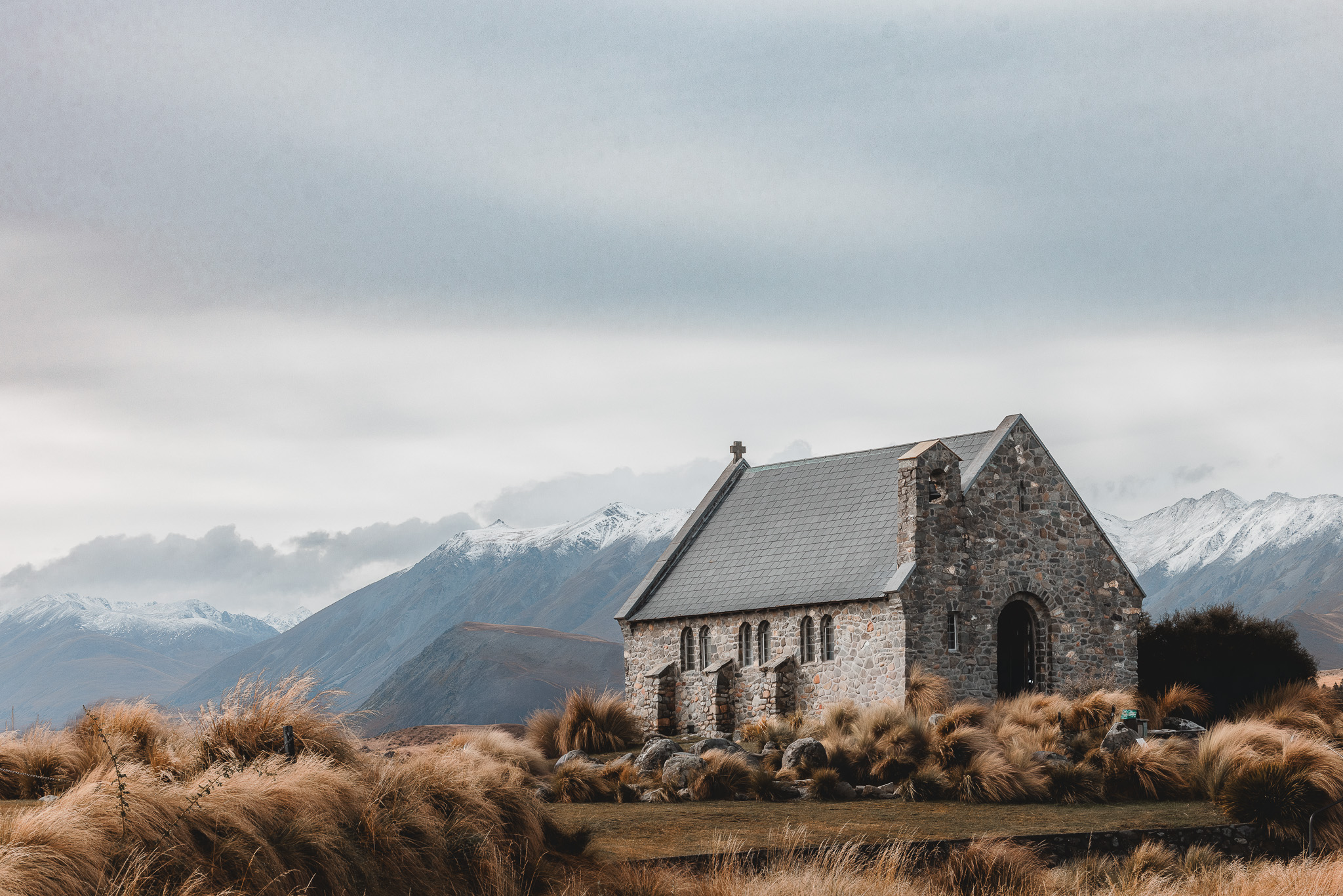
Climb to the Mt John observatory for the big-sky view over Tekapo (ours was a last-minute call and immediately worth it). Down on the lakeshore is the Church of the Good Shepherd — a tiny stone church against all that openness. An overcast sky is a gift here, not a setback.
The train + the ferry — shoot the coast, watch the weather
The Christchurch → Picton train (spring for first class; you’ll be wined and dined past open-air coastal views) hands you the South Island’s coastline on a plate. Then the ferry across the Cook Strait to the North Island — smooth for us, and the last one to make it across for a couple of days as the weather turned. Check the forecast, and don’t dawdle.
The prints
A lot of these stops came home as photographs, and several are becoming prints in the shop. If you’re just starting a wall, start with a postcard. That’s how every collection starts.
I didn’t plan this one. Which, if you ask me, is usually when the good ones happen.
We’d been photographing our way toward Christchurch — the lone Wanaka Tree standing out in the lake like it knows it’s being watched, the impossible glacial blue of Lake Pukaki, a last-minute detour up to the Mt John observatory because someone (me) couldn’t help himself. We stopped for lunch by Lake Tekapo. And there, right on the shore, was this little stone church.
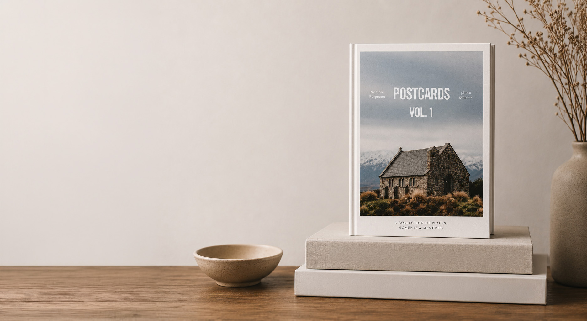
The Postcards Collection – New Zealand Lake Tekapo Fig 1 – Framed Print
The Church of the Good Shepherd has stood on that spot since 1935 — which is to say, longer than anyone I thought to ask. It’s small. It’s plain. And on the day we were there it was flatly, gloriously overcast: the kind of grey light photographers pretend to be annoyed by and secretly adore, because it turns the entire sky into one enormous softbox.
I set the lake in front of it, the mountains behind it, and the little church in the middle of all that openness — and I knew before I’d taken the frame that it was the one. It’s the whole New Zealand experience in a single picture: just enough man-made to feel like home, sitting right on the doorstep of the wild.
What New Zealand actually feels like
Raw, untouched beauty is the closest I can get. It feels like the end of the earth — hostile enough to keep you honest, cold enough to remind you you’re a guest, and beautiful in a way that, somehow, no one has managed to wreck yet.
(I also came home with an indefensible number of photos of highland cows. New Zealand has the best-dressed livestock on the planet, and I will not be taking questions.)
Exhibit A. I rest my case.
The postcard
The church became part of the Postcards Collection — with a print for the wall, if a small church at the end of the earth earns a bigger spot in your house than a postcard rack. Start with the postcard. That’s how every collection starts.









&url=https://prestonferguson.art/product/i-could-be-in-new-zealand-but-travel-plans-never-left-the-group-chat-vintage-travel-postcard-pack-of-10/&media=https://i0.wp.com/prestonferguson.art/wp-content/uploads/2026/06/2b2883bf-dd32-4d2a-8464-72afe3b86d1a.jpg?fit=1024%2C1024&quality=89&ssl=1)


